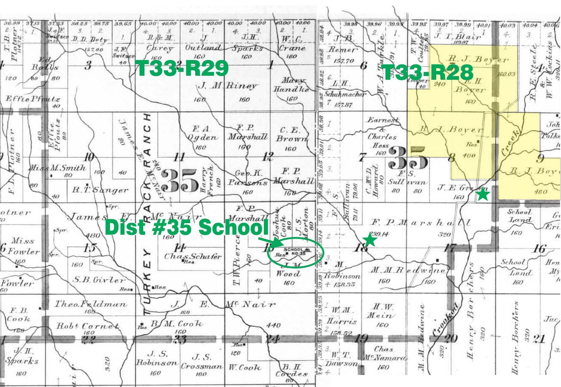
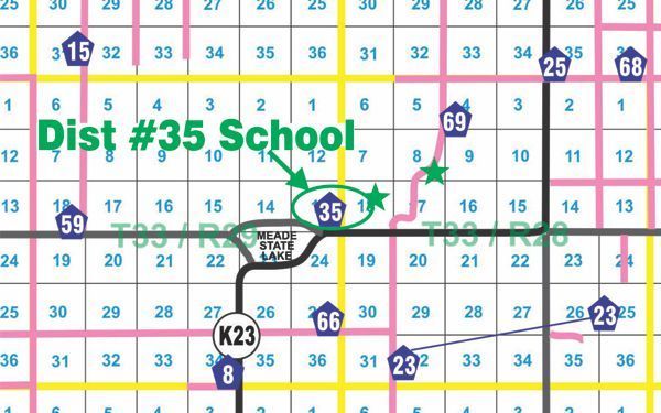
Boyer (Marshall) School - District No. 35 - Meade Center Township
District #35 formed in September of 1886, and was active until it consolidated with District #25 in the fall of 1916, to form the new District #69.
We have no photos of this school, only scant public records and tidbits of family histories. The schoolhouse was located in three different places during the life of this school... the first one being in the SE/4 of Sec 8-T33-R28. The second location was in the SW/4 OF THE NE/4 OF SEC.18-T33-R29. Eventually it ended up in the NE/4 OF THE SE/4 of Sec 13-T33-R28... just east of what is now Meade State Lake. (see maps below)
It was sometimes called Boyer, sometime Marshall, familiar names, both in the list of school officers and land ownership, and the first three teachers were named Boyer.
Surnames of students in District #35 were: Adams, Boyer, McPheter, Neese, Russell, Senger, and Vogt.
Teachers of Boyer School
Boyer, Meda - 1891 - 1893
Boyer, Gertrude - 1904-1905
Boyer, Ethel - 1905 - 1906
McDowell, Sadie - 1913 - 1914
Dalgarn, Kay - 1914 - 1915
Spratt, Bertha - 1915 - 1916
Hughbanks, Mrs. Lon - 1916 - 1917
We have a lot of missing years in our teacher's list between 1893 and 1904 and between 1906 and 1913.
Surnames of students at Boyer school:
Adams, Boyer, McPheter, Neese, Russell, Senger, and Vogt.
From the Edward H. Boyer history:
Meda taught school in a sod school house on the flat just east of the present Meade County State Lake. In 1889, she rode horseback and sister Gertie, coming six years old, rode back of the saddle to school. There was some excitement at school one morning when one of the children discovered a bull snake lying on the sod just under the eaves of the roof. The big boys herded it outside and dispatched it.
(This story sounds like the schoolhouse was a sod house.)